Check out the latest finds on google earth, here we list all the strange and unexplained mysteries found on google earth.
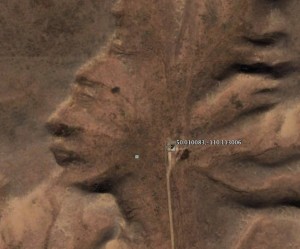 The Badlands Guardian.
Coordinates: 50° 0’36.30?N, 110° 6’46.82?W. The Badlands Guardian was one of those mysterious places that was first discovered by Lynn Hickox utilizing the Google Earth program. Although this area is a completely natural geological feature in southwest Alberta, Canada, one cannot help but notice the striking resemblance of a human head wearing his full native American headdress. Some have also claimed that the figure appears to be wearing earphones, which is nothing more than a road leading to an oil well. Even though this area is a natural formation, it is amazingly ironic to see these arid badlands formations resemble the fully detailed shape of the very same indigenous people that lived in these lands
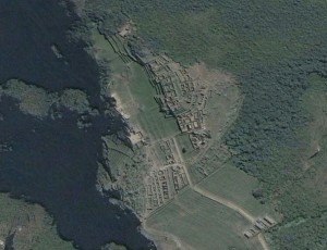 Machu Picchu.
Coordinates: 13° 9’49.69?S, 72°32’42.65?W. Located on a mountain ridge above the Urubamba Valley in Peru, Machu Picchu is considered one of the most mystical sites on our planet. Machu Picchu is a pre-Columbian Inca site built around 1400 AD. The area only thrived for 100 years and the place was abandoned following the Spanish conquest of the Inca empire in Peru. Theories of its purpose range from it being the birthplace of the Incan “Virgins of the Suns”, an estate of the Incan emperor Pachacuti, a prison for the select few who commit extremely heinous crimes or as a settlement to control the economy of the conquered lands.
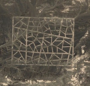 Strange Carved Lines in China.
Coordinates: 40°27’28.56?N, 93°23’34.42?E. There isn’t much information available on these strange, yet beautiful mosaic lines carved in the desert of the Gansu Sheng province in China. Some records indicate they were created in 2004, but nothing that seems official. Of note is that these lines are somewhat near the Mogao Caves, which is a World Heritage Site. The lines span a very huge distance and yet still retain their linear proportions despite the curvature of the rough terrain. Perhaps this is a military site to test kill probabilities of Chinese missile systems. If utilizing Google Earth to view this feature, you will notice many questions from fellow Googlers wondering what this feature is and its intended purpose.
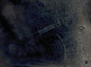 Atacama Giant.
Coordinates: 19°56’56.88?S, 69°38’1.87?W. Our last example of mysterious places found on Google Earth is also located in the Atacama desert of Chile. The Atacama Giant is the largest prehistoric anthropomorphic figure in the world and measures 282 ft long. Records indicate it was built around 1000 to 1400 CE. Although some skeptics and “ancient aliens” believers think this is a representation of alien visitors who have visited the Incans, the Atacama Giant’s unusual features actually have a specific purpose. Not only does this true giant represent the diety of the local people, but the various points around his head could tell the local inhabitants various calendar events such as the day and season and when to plant certain crops. This was accomplished by how the moon would set in reference to these points

![crop-circles[1]](https://coolinterestingnews.com/wp-content/uploads/2012/07/crop-circles1.jpg)


